Sunday, October 31, 2021

Sir Alan Cobham African Adventure: Leg 2, Hamble to Bordeaux

 Cont'd:

November 18th. Planned day of departure following yesterdays arrival from Rochester via Westminster.

Weather stepped in to the picture today, with howling gales from the south that would reduce their 500 mile journey to just 40 to 50 mph, to say nothing of the discomfort battling against the blustery headwind.

The following day wasn't much better. Sir Alan and his crew made a short exploratory attempt to depart for Bordeaux, but fog quickly wrapped around them leaving little option but to trace their route back from over the Isle of Wight and again down onto Southampton Water. 

Finally, on a grey overcast November 20th 1927, they were able to leave the historic Hamble mouth and set a course to the Needles on the west of the IOW and then on southward. With the Aeroplane serviced and loaded and goodbyes given, they taxied away from the Fairey Aircraft works on the Hamble river mouth looking over their shoulder toward the incredibly historic naval and aviation area. I am sure that among the crew there must have been more than one thought that they too were destined to add another leaf into the rich Hamble history books.

Note, most images will enlarge if clicked upon. They can then be collapsed via an x in the top left corner.

Area 7 indicates the old Fairey Works Location. Please visit http://www.delscope.co.uk/aviation/hamble.htm to whom this map belongs.

Virtual Flight Log: 20th November 1927.


According to the weather forecast, the conditions are far more favourable today, although overcast and grey. We will be flying into increasingly warm air and light winds but rain is likely to become a reality as we approach that centre of pressure very close to our Bordeaux (Lake Hourtin) destination. Initially we should expect moderate winds from the South East and these are likely to reduce as we go south. I imagine it might be possible to encounter some mist and fog, always an aviator's worry.

As we set off please keep looking in, I will continue to document the flight:

Departure:
Here we go as we taxi out into our virtual Southampton water adjacent to the Hamble river mouth, I note the wind direction as the virtual Singapore I weathercocks into the wind.
Taking a poignant moment to look to my starboard landscape, in this virtual world there stands a 650' landmark, Fawley chimney has stood here for almost 50 years and has become part of the skyline for shipping and aviation, I have used it for a reference on my solo cross country Nav-Ex  in the early 90s and many times since in the sim and for real. Sadly, as I was taxiing out for the flight yesterday (Sunday) morning, the chimney was no longer there in the real world, for at 7.00am that very morning it and the surrounding power station were dramatically destroyed in controlled explosions ready to make way for a 1500 home, new waterside Fawley complex. Good bye to a great landmark that many a traveler might have been relieved to see as they anxiously glance up from their charts... assuming they are not too close and below 650' of course!
I'm glad it will be with us in the sim for a few more years, although it is actually out of place as I accelerate the Singapore and coax it onto the step in this 1927 November 20th revisited.

If you are interested in the death of the chimney here is a short clip: https://www.youtube.com/watch?v=cFx2n91glq4

We are clear of the water, it is my plan to orbit the chimney out of respect and climb to 2500' before setting 225 deg for the Needles (the wind is on the nose for this leg, but we will carefully keep an eye on the time to check the ball park wind direction and strength before turning left to Guernsey). Strangely I had a technical distraction that resulted in some sloppy, although safe flying. The virtual engines sounded different and this was odd. It seemed like the .wav file for full throttle had a slight break in each loop cycle. This resulted in a check of the gauges and a confirming look back at each propellor to make sure all was turning, we certainly had ample power. Throttling back made a difference and as I was by now above my intended height I rolled the throttle back to a lazy 1700 rpm and continued on.
At the Needles I turned left onto an initial 210 degrees and set out for a 100 mile sea crossing into rain and ever reducing grey overcast ceilings.
I had set the sim weather as close to Alan Cobhams trip as possible although I think his wind may have been stronger.
Sir Alan mentioned in his book that he applied the same navigation method as he and his co pilot, a fellow RFC officer named Worral, had picked up in the war. He doesn't say exactly what the method is but, I suspect it must have been similar to how I was taught as a ball park method when flying single handed with a thumb on the map. I had worked some scenarios into the flight plan before but I really wanted to do as much of this "on the hoof " navigation as I can to give a little more uncertainty and challenge. I roughly worked out the max drift possible for the aeroplane [nominal 0.75 of windspeed] as 12 deg with 16kt windspeed, having factored that into the known wind on departure. The wind was thought to be about 250 deg / 16kts.
Taking the three memorised figures (from my old instructor) of Sin 30 = 0.5, Sin 45 = 0.7 and Sin 60 = 0.9 we can make a simple calculation, in our case the ball park figure was 40 degree off the nose wind  is equal to sin 40 deg which gives 0.7 of max drift, resulting in a nominal 8.4 deg drift. With this in mind and backed up by the flight plan scenario, we noted and made a turn into the wind of a nominal 6 degrees. My reason for 6 degrees was a compromise failsafe just in case the wind was less than expected we would be less likely to track out into the Atlantic, risking missing the channel islands altogether, but drift toward France, a much safer option in these conditions of poor visibility. Should there be any problem and the channel islands do not come up in the timing period, we can make an educated guess and turn to port to intercept the French coastline.
The flight continued and I watched the clock very closely. The sea was 85% covered by low misty cloud the rain lashed from dense cloud ahead. I strained to look out to the virtual sea as the time of waypoint arrival drew closer, and then, by incredible chance, I glimpsed a glow low to stbd just ahead of our nose. It was only in view for a moment, a rocky outcrop with a light house, but still surrounded by huge amounts of sea. An attempt to count the light interval as an identification failed as the lighthouse disappeared in the mist. Quickly I turned to the chart and there to the NW of  Guernsey by quite a long distance I found the outcrop. I quickly "eyed" a new track on the chart and turned the Singapore a few degrees to port, beginning a careful let down through the mist before we arrived over any land. I once again strained my eyes for Guernsey and Sark. By turning a little more to port, I felt that increased my chance of landfall even if it were France it would be better than travelling too far to the west and missing everything!

Can you see the lighthouse just below? A lucky time to glance overboard and thank goodness for an open cockpit.

Finally the islands of Guernsey and Sark loomed into view ahead, quickly followed by the more distant outline of Jersey. I (along with Alan Cobham and all aboard), breathed a little sigh of relief as the trip today would be very much more straight forward from here... weather permitting.
I gave a thought of my own past as I swept by a  mist covered virtual Guernsey, to use a phrase from author and test pilot Harald Penrose, the mist draped in the valley as a "discarded wedding veil". Not only a perfect description but in my case this was very apt as this island was the location for our bicycling honeymoon quite a long time ago.
The weather was really beginning to clear for the moment as we set off toward Brest knowing that even with a maximum possible drift, we would comfortably make land fall as the coastline will stretch right across the front of us, filling the horizon when we arrive at a nominal 2000'.

Ah, Guernsey ahead!

From here to Brest was quite straight forward, no concerns or dramas. One thing that did cross my mind was how wonderful it is to fly without a care in the world. By this I mean the effect of not having a particular responsibility of having to know ones exact position. As far as I am aware in 1927, there were very few precise areas of restriction, airspace and the like and it didn't matter if we wandered a little off course, indeed I understand it was quite normal if  a passenger requests a small detour to view a particular feature... providing it didn't cause a particular delay to the schedule and possibly it was wise to stay true to course where there is a weather or remote terrain risk.
Having traversed the Brest peninsula, which once again bathed us in poor visibility, we aimed to set course along the Brittany coast. 

Looking toward Brest in very poor low level visibility.


This we did with a left turn S.E. along the obscured misty beach and cliff lines. But here began a little series of unintended course deviations, "no need to worry the passengers" but we spent a good 30 mins playing catch up from chart to clock to the view that greeted us out of the cockpit. For a while none seemed to agree with each other. Despite this, there was no real worry as we knew it would sort out as long as we simply followed the coastline ticking off Quimper, Lorien and making our way between the islands on down toward Bay de Quiberon. 
Now such things as distinctive bays and islands would make you think it no problem (I did!) with such obvious landmarks. The fact is, I turned a little early over a group of watery inlets at the beginning of the coastline interception and additionally the sometimes pretty dense, low mist that urged us to turn away and parallel the coastline, maintaining low level below the misty and rain clouds at a safer distance from the high edged cliffline. All made a contribution to our definite edge of the seat poise for a short while.
Finally things settled down having made a very further poor judgement of following an estuary and floodplain for a short while inland before I realised my mistake. Marshland looks very insignificant on the chart or map, it looks like land. Here below me the flooded land made a great impression of harbour and coastline for quite a way before I realised my mistake, hurriedly turning right overland toward what must be the real coastline beyond the mist.... mustn't it ? I am pleased to say that yes it was and we curved back southward assured of our coastline route as the mist began to lift.
So the moral of the story is don't become complacent. In theory little could go wrong simply following the water's edge. But, I had not allowed for goldfish bowl views, extensive flooded marshland and I had neglected the compass course and my biggest ally, the clock. 
"Feeling very chastised. Point taken". 
From here I carefully logged Brittany overhead time, and plotted for the expected La Rochelle and Gironde times of arrival. Noting fuel levels at La Rochelle as 25% remaining, very good as we didn't have to far to go as the light began to draw into an autumnal evening. 
A few local photos of the Lake Hourtin which went on to be a haven for flying boats along with nearby Bicarosse, gave me a good insight into what to expect. We were due into the north of the lake which sits parallel to the coast by less than a few Kilometres, surrounded by dune beaches and pine forest.
Finally it came into view and we overflew from the coastline, turned  back and into the wind for a gentle landing and taxi to where I thought we were meant to be, I was not quite in the right place which required the Singapore to be dragged (slewed) to the opposite shore for the night.
Here Alan Cobham and his crew had a great evening. Local restaurants fed and wined them to a high standard of merriness with good down to earth food and local wine. The crew happily made their way to bed, but what an adventure this unraveled. As if they had not had enough altitude for the day, they were confronted by huge tall beds typical for this historical area of rural France. The tallest crew member is nominated to give each of the shorter members a "leg up" atop the towering nest, finally he then had to resort to a chair and a leap of faith, at last to slump aboard his night time perch.

Brittany coast view from the bow cupola .... through goggles!

Lake Hourtin comes into view

Bicarosse post 1927, similar to the Lake Hourtin location although this may be a little larger and more grand.


To be cont'd with a new post Leg 3.


Friday, October 29, 2021

Virtual Airlines. DC3 Airways

 Just as a short interlude between the next leg of Alan Cobham's African adventure. I mentioned how the FSX platform can provide a doorway to many real life historic events. For example, a little while ago I became particularly interested in the 1948 /'49 Berlin Airlift having become engrossed in various books and articles, it was then really interesting to fly the legs in the sim as realistically as possible. Much of the navigation radio and waypoint system has been modelled by very clever third party enthusiasts in FSX and other platforms, enabling us to enjoy a great deal of authenticity in the flying, but also the planning stage.

Along with the Calclassic website, this DC3 Airways site has a considerable amount of files and members with great experience (often in real world operations), to allow the past to come alive and, ironically, become a "living history" event in your own home.

Here is a link to: https://dc3airways.net/ and to Calclassic http://www.calclassic.com/

It is important to say that by downloading the aircraft available through these sites you are most likely to experience very realistic flight characteristics. Sometimes the model may not look as crisp and detailed as the creations from the professional companies, but because there is such a wealth of real world knowledge here, the experience input by members counts for a great deal as far as realistic flight and handling is concerned. Combine this with very realistic weather effects from the integration of live current weather updates and navigation that is exactly as the real world and you have a very thorough aviation workout, should you choose.

In the video I have just downloaded this DC3 Airways aircraft and this is my first trial ready for my assessment  by a DCA administrator; once I have everything working and I am up to scratch! As you can see I have work to do :). Although I didn't show it in the short clip, the cockpit is just as detailed and operational as the outside view.

I have not flown a real world DC 3 / C47, but I did fly in one at Air Atlantique / Atlantic Flight Training here in the UK. It does behave in the sim as I imagined. 

Albeit having a single engine, I think the closest real world aircraft to the DC3 that I have very briefly flown in circuits at Kemble UK, is the AN2 Antonov, that was very surprisingly heavy and of course very slow all-round, especially in roll. But on the other hand you felt that the aeroplane uncannily knew what to do in each stage of the circuit. There is a brilliantly authentic AN2 in FSX, I am sure we will be doing something with that in the future on this blog.

Now back to the DC3 circuits! I can see issues already, I have not switched nav lights or landing lights and cowl flaps are wide open too... I have a real world policy to avoid flying with anyone that does not use a checklist on a complex aircraft... point taken, time to print those checklists.


Friday, October 22, 2021

1) Sir Alan Cobham and the Short Singapore, African Adventure.

 As a first shared adventure, I would like to introduce Sir Alan Cobham, a great aviator with a vast range of flying ventures and services to aviation. Today, I can still see his legacy on a regular basis as his company aircraft route out to sea. My home county of Dorset echoes with links to Sir Alan's past.

In 1927 Sir Alan planned, not for the first time, a trip to Africa. For this journey he would be in a larger aircraft, the Short Singapore Mk1 flying boat. His trip to circumnavigate Africa, planned to depart from Short's works in Rochester, overfly London to wave to the nation high over the city at 2pm sharp, a lofty "GOODBYE" before turning left and flying on to the south of England home base to arrive on the Hamble River.

This short first leg was not without some not too serious adventure and mis-adventure. To quote one of his crew, commenting with a back drop of  shouts and cries to "cast lines and get out of the way you ***** fool", "This is nothing compared to the normal arrival of a flying boat in an unsuspecting creek or river as we go south"

The stage is set.. 17th November 1927:

We are preparing for the initial flight from Rochester, following the Thames river via goodbyes over London, the river is to provide a possible landing site should we need it (flying over land in a flying boat, poses similar concerns to flying over water in a land plane). We then turn left for a forty mile overland hop to Hamble, Southampton on the English south coast.

In the modern world, Google maps and consultation of historical sources indicate where in Rochester Sir Alan might have departed from. We will produce a flight plan but leave the weather input until just before departure on the day. We will be considering fuel and heights, although most of the flight will be at low level, in fact, the Singapore rarely ventures above a nominal 5000ft. If we had weather information for the period, we can dial that into FSX, however I like to use real world weather where possible, just to give that little uncertainty and navigation anomalies. here is a link to the real world weather and cloud provider that I use, it is free in the UK and a nominal £5 or £6 annual fee if you leave the UK and wish the service to continue in FSX abroad. Open Clouds

Log notes: 24/10/21 [17/11/27]

As Alan Cobham arrived and boarded the Singapore moored and already running in the Medway, I too have entered the simulator aboard the Singapore gently floating in a moderate, south wind, early winter lunchtime light.

Today has been fairly leisurely, an inspection of the weather chart for this 17th November1927 has allowed a judgement to be made on what we might expect, perhaps Sir Alan might have thought "mmm there's a surprise, no rain for a change" as this year had a dreadful record of rain and storms. Perhaps Noah might have contemplated a flying boat in '27? 

 We are sandwiched between a low pressure out over the west coast of the country and high pressure to the east in the North Sea and eastern English Channel. We have a fairly moderate overcast day of 10 deg C temperature and winds are an nominal 10 kt SSW direction. Just right to help ensure that  G-EBUP  is off the water well before the M2 viaduct and high speed rail link crossing that span the river barely a mile ahead. Built in 1963 and developed by 2003, this had not been an issue for Sir Alan and his Crew.

"Uniform Papa" or "U for uncle. P - peter"? The phonetic alphabet has just been adopted this very year (1927), but it seems there were still considerable differences in levels of adoption within countries as well as internationally. Many military forces continue to use their own adaption that had been slowly evolving since WWI.

You might like to download this and play on repeat quietly in the background whilst you read this first part of our departure before the engines roar. Water Ambience (best set to repeat in your player)


Settled in, here we go with a Morse signal from Uncle Papa: Cast off. Engine Start. Make ready


Noting the time; 13:35, we must not be late for our 2pm London goodbye. A very limited pre flight check is carried out as there are no flaps, undercarriage, variable props or brakes. We can do a full and free control operation test, something that works even on the PC as I had forgotten to plug my rudder pedal USB in! Temperatures and pressures are all good, the gauges mounted on the engine pylons and duplicated in the cockpit. We slowly throttle the two virtual R-R Condor engines and monitor the gauges, given more room and in the real world, I might have carried out some high speed taxying whilst testing individual magnetos (two per engine), however the Singapore 1 has no water rudders and turns in a confined space are not possible, even with one engine off in the direction of turn as far as the sim is concerned and most likely for Sir Alan to some degree.
We begin to move, the control wheel is held hard back, much the same as a tailwheel land aircraft. In our case it keeps the water spray well aft as well as inviting the almost ten tons of aeroplane up out of the power sapping water to transition onto the planing hull. 
We have now applied full power and the whole aircraft comes alive, she lifts gracefully to skip across the surface with a little balancing forward pressure on the control wheel to make the most of our new found nimble skim over the glittering surface. After less than twenty seconds of thrilling ski ride, we launch into the air with a light tug to unstick the water's last outstretched finger tips. We climb, shallow at first to build speed to 65 or 70 mph and then climb more steeply, clear of the looming M2 viaduct.
As the high speed rail link of today sweeps beneath our northerly tilted wings, we are an elegant white sailed tall ship leaving the race of the virtual modern world beneath us. Perhaps those who travel over the Medway approaching 200 mph in a real world modern train, might one day glance up and think of these outstretched wings setting course for an African adventure almost a century before.

We turned back over Rochester and gave a wing waggle as much as is possible with this very slow roll rate and high yaw requiring great big rudder inputs. I think it must have looked more like a large bull like swagger than a crisp farewell gesture.
Now to set for London at 2pm on a run up to tower bridge. This has been a new experience for me, I am not quite so relaxed on the part of the trip. The Singapore is very easy to fly as long as everything is pronounced and progressive. I feel it is best not to rush any maneuver, especially descending! The area is very alien to me, I have never visited the Rochester and London east area and I don't know London at all well. The weather had been brighter than expected and the river line made it easy for me to offset for drift although I should mentally note this for my route out toward Reading as the full crosswind effect will be giving me a bit of a push north.
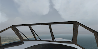
Alan Cobham writes how the Thames is ideal for flying boats, and I have to agree with this great expanse of runway ahead of me, potentially very relaxing... but later he comments and withdraws trhat statement as he makes his way up the river between great tall buildings next to the 100 ft wingspan and I too agree. Sir Alan dropped down to 500 ft, something I was not prepared to do even in the Sim, 625 ft at 70mph was my lot! As the Shard and other high rise buildings swept by my wingtips I was happy to climb back up to 1000ft or so. I could imagine Lady Gladys standing in the cupola behind me, hair wildly flailing and a waving hand to match as we said goodbye to London, see you again soon!

From here I had a pretty good time re-enacting this now fairly relaxed virtual flight. I continued lazily westward toward the Staines lakes having peered down at Big Ben to read the time before finally straightening up over the Battersea and Chelsea area.
My wife, Bryony, came along to look over my shoulder at about this point. She was born in Chelsea although she didn't ever live in London for very long before her family moved to rural Wiltshire. 
What I found intriguing, was how the overfly of London had really captured her attention, she drew a chair up next to me and became quite engrossed. To see this, quite demonstrated the potential lure of simulation. She had already been reading Alan Cobham's book (a nicely aged and battered 1932 reprint of his original 1930 account "20,000 Miles In A Flying Boat").


We held a westerly course very loosely until Windsor Castle, I had over corrected for the wind, picking up the castle a little more south than intended over such a short distance. I have to say that I was now getting into an area that I knew considerably better than the east. My navigation was becoming a little sloppy because I knew that setting south from here would simply bring me out on the south coast and an easy flight along to Southampton, with local knowledge, clearing weather and the absence of any airspace restrictions (as far as I know for 1927) I could just point and fly without a care to radios or infringements... that I do envy of Alan Cobham and all aviators of this period. In fact I am too carefree enjoying this flight because I should have been strict on monitoring my drift and the general tendencies of this lovely aeroplane so that I might be able to have better knowledge when I leave for France and on south tomorrow (subject to weather as I am conscious of the damp warm air coming up from the south west... maritime air... which might mean fog for tomorrow?)

In no time the English channel is before us and to my right the sunlight is glistening on the Solent, we turn starboard, I can imagine our marvelous white outstretched wings baring their underneath to the water reflected sunlight, we must look very majestic. Slowly we float down over the Hamble and have a good look at the adjacent Southampton estuary ready for landing, making sure all is clear of shipping and noting that Ken has some marker bouys out. We call ahead our position with Dits and Dahs of Morse code and state our intention, perhaps a little cheekily we also dit-dah ahead to put the kettle on .... a nice cup of tea please!
We swoop around over what will be the Empire Boat base and head more or less into wind for finals to land. Finally with a little right wing down and top rudder to help us with the slight wind off the starboard bow, then straighten up, floating, engines whispering, floating, holding off, a little trickle of power from the big R-R Condor V12 engines and finally we touch Southampton water just a little before the Hamble.
A moment before Uniform Papa sinks off the plane, I try to rudder over toward the Hamble, but it is too late, without adding a lot more power and more fuss she is not going to turn to port... I was too slow and relaxed. No matter, the tender will come a take us in tow to the Fairey Aircraft workshop frontage for our overnight and final preparation for tomorrows big trip when the expedition properly starts with Leg 2. Very much more serious from then on.
There is always a particular feeling when I unlatch a door or window, or simply sit in an open cockpit a moment after shutting an aircraft down. The various instruments wind down and the engines tick as they cool. But it is the silence.. the feeling of achievement; very deeply inhaled and held for just a moment. That is a very special time.


On the other hand by contrast, Sir Alan and crew were greeted by a most willing, but uninformed, motorised Yacht charging toward his rotating propellers. Seriously concerned the Singapore crew gesticulated to stay back, finally a stern, "punctuated" shout from Alan to stay away did the trick, Lady Cobham felt it time to return into the Salon as a matter of manners, Green the engineer assuring her this is perfectly normal when a flying boat arrives. 
Ultimately the situation resulted in a near garroting of the yacht's well meaning helper in a dinghy as the rope took up slack and the official tender launch, whilst competing for position, colliding with the yacht which by now proudly had the Singapore in tow!

Ahh nice cup of tea...

Please note, as with the post, this video is a work in progress please revisit regularly.
I am working toward gathering all permissions and thank those whose material I have used to help in my illustration. I will give a final credit and bibliography before completion of the post.


More from Bronson Creek FSX

Bristol Freighters were used regularly moving ore enriched with gold from the Snip Mine to Wrangell 25 mins to the west. I thought what if ....